
Services
Our services
Comprehensive Land, Geospatial & Infrastructure Solutions
At Geomatix Land Use Services Ltd (GLS), we provide professional surveying, mapping, engineering, and land management services that support sustainable development. Our team combines field expertise, advanced technology, and industry best practices to deliver accurate data, reliable insights, and practical solutions for government, private sector, and development partners.
Reliable Surveying & Geospatial Solutions
- Precision Field Surveys
- Secure Land Documentation
- Smart GIS Mapping
- Soil & Site Investigations
- Timely Project Reporting
What we offer
Explore Our Professional
Land & Infrastructure Services
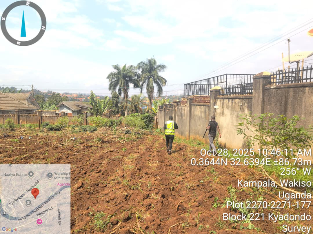
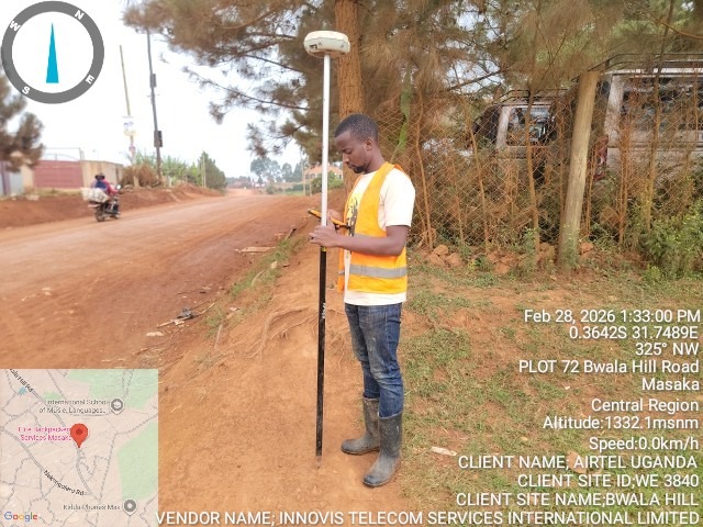
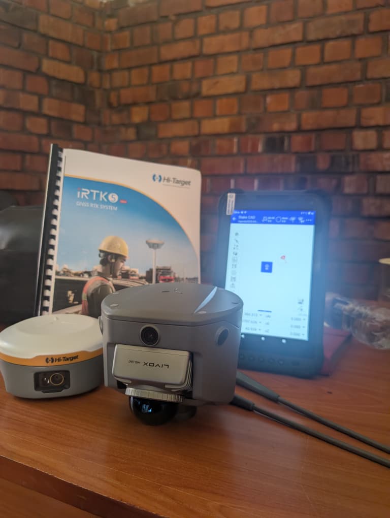
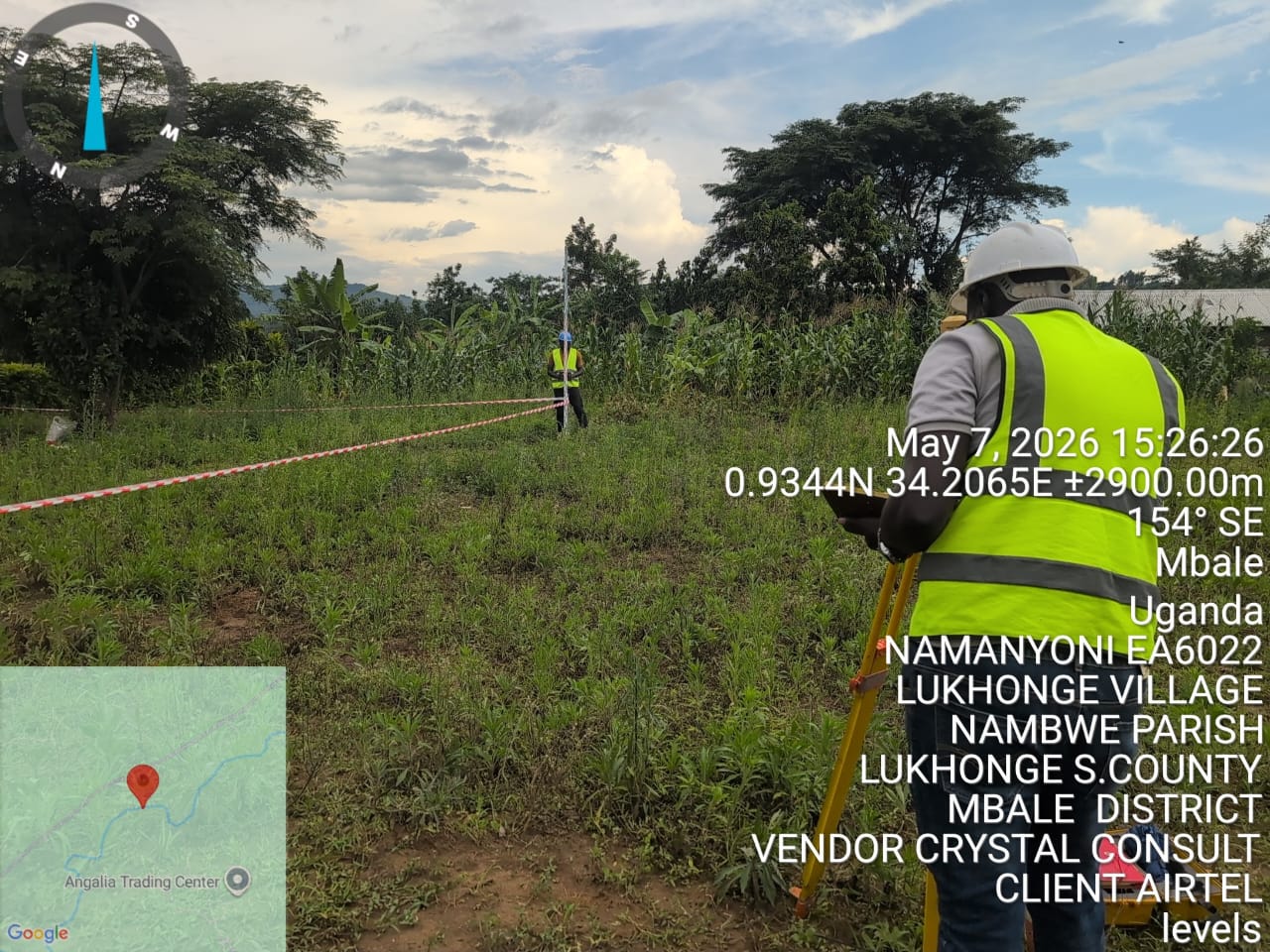
Land Surveying & Mapping
We deliver precise topographic, cadastral, boundary, engineering, and UAV (drone) surveys using advanced GNSS and Total Station technology.
Services Include:
- Cadastral & boundary surveys.
- Topographic mapping.
- Drone/UAV mapping & photogrammetry.
- As-built & engineering surveys
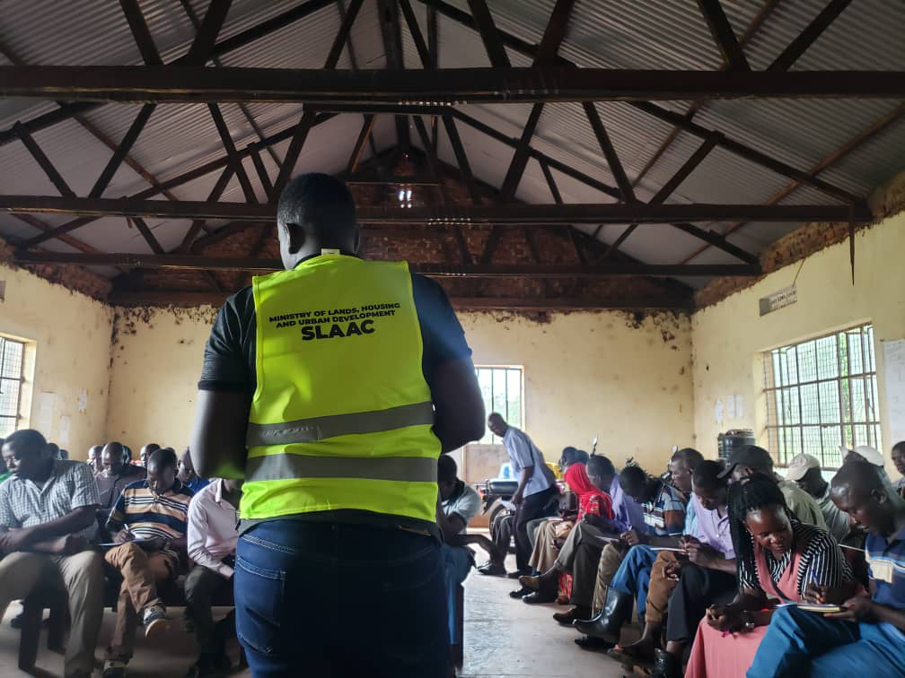
Land parcel demarcation for certification (SLAAC programs)
GIS & Remote Sensing
We offer full GIS and remote-sensing workflows — data collection, analysis, mapping, visualization, and reporting.
Services Include:
- Spatial data analysis.
- Satellite imagery & drone data processing.
- Digital mapping.
- GIS database creation & management.
- Thematic maps for planning, environment, & infrastructure.
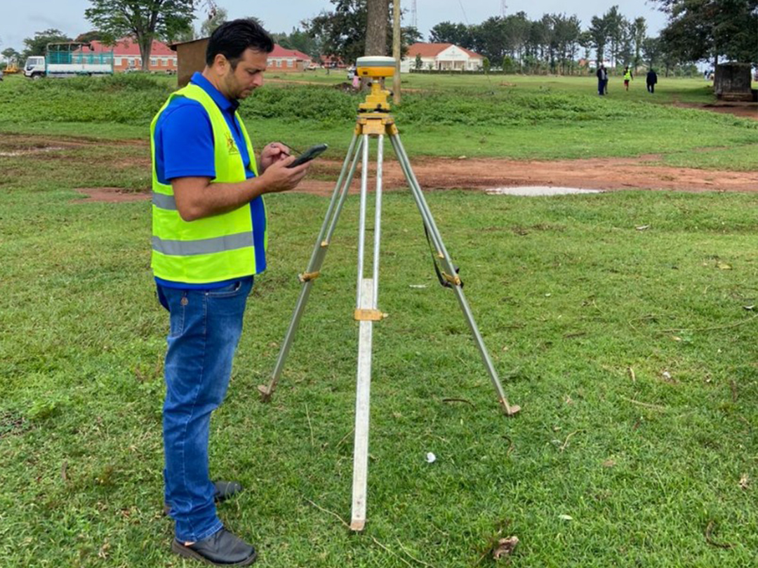
Engineering & Infrastructure Surveys
Technical support for civil works, construction planning, and infrastructure development.
Services Include:
- Road & route alignment surveys.
- Construction setting out.
- Leveling & deformation monitoring.
- Bridge & drainage surveys.
- Site design support for engineering teams.
Land Use Planning & Development
GLS works with districts, municipalities, and private developers to create sustainable land-use plans.
Services Include:
- Physical development planning.
- Urban & rural land-use models.
- Zoning & site suitability studies.
- Layout plans for estates & townships.
- Support for planning approval.
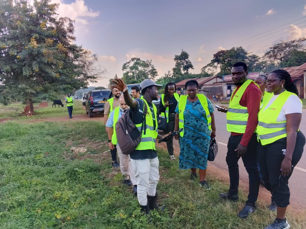
Environmental & Social Impact Surveys
We conduct field assessments that help clients evaluate risks and meet regulatory standards.
Services Include:
Baseline environmental surveys.
Social data collection.
ESIA spatial mapping.
Community engagement mapping.
Compliance documentation.
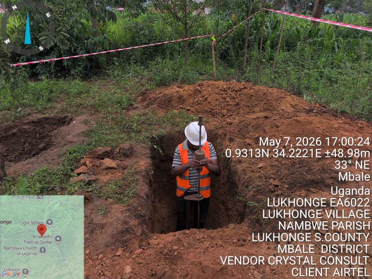
Land Acquisition & Geotechnical Investigations
We help clients secure suitable sites through land verification, documentation, soil testing, and geotechnical assessments for confident project planning.
Services Include:
- Site Acquisition.
- Land Verification.
- Land Documentation.
- DCP Soil Testing.
- Geotechnical Assessments.
- Foundation Suitability Analysis.
- Technical Reporting.
Consultancy & Training
We build capacity for institutions, local governments, and private organizations.
Services Include:
- GIS (ArcGIS, QGIS, AutoCAD, Remote Sensing).
- Surveying equipment operations (GNSS, Total Station, UAV).
- Land documentation & management systems.
- Data analysis & visualization.